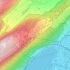
Evilard topographic map
Click on the map to display elevation.
Evilard
The municipality reaches to the height of the anticline of Montagen de Macolin. It includes the town of Evilard, which is surrounded by Malvaux (German: Malewagwald, up to 765 m (2,510 ft) altitude). To the southwest, the municipality reaches in a narrow strip over the Magglingen to the peak of the Magglingerberg, up to the municipal high point of 1,070 m (3,510 ft).
About this map

Name: Evilard topographic map, elevation, terrain.
Average elevation: 583 m
Minimum elevation: 424 m
Maximum elevation: 936 m
Other topographic maps
Click on a map to view its topography, its elevation and its terrain.