
Thank you for supporting this site ❤️
Make a donation
Make a donation
Gear up for your next adventure:
As an Amazon Associate, this site earns from qualifying purchases at no extra cost to you.
Ham topographic map
Click on the map to display elevation.
Thank you for supporting this site ❤️
Make a donation
Make a donation
Gear up for your next adventure:
As an Amazon Associate, this site earns from qualifying purchases at no extra cost to you.
About this map
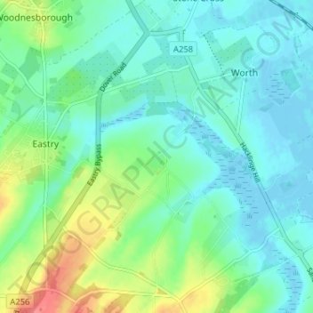
Name: Ham topographic map, elevation, terrain.
Location: Ham, Eastry, Dover, Kent, England, CT14 0EB, United Kingdom (51.22549 1.31025 51.26549 1.35025)
Average elevation: 16 m
Minimum elevation: -3 m
Maximum elevation: 60 m
Thank you for supporting this site ❤️
Make a donation
Make a donation
Gear up for your next adventure:
As an Amazon Associate, this site earns from qualifying purchases at no extra cost to you.