
Thank you for supporting this site ❤️
Make a donation
Make a donation
Gear up for your next adventure:
As an Amazon Associate, this site earns from qualifying purchases at no extra cost to you.
İğdemir topographic map
Click on the map to display elevation.
Thank you for supporting this site ❤️
Make a donation
Make a donation
Gear up for your next adventure:
As an Amazon Associate, this site earns from qualifying purchases at no extra cost to you.
About this map
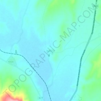
Name: İğdemir topographic map, elevation, terrain.
Location: İğdemir, İhsaniye, Afyonkarahisar, Aegean Region, Turkey (38.94453 30.48226 38.98453 30.52226)
Average elevation: 1,068 m
Minimum elevation: 1,047 m
Maximum elevation: 1,182 m
Thank you for supporting this site ❤️
Make a donation
Make a donation
Gear up for your next adventure:
As an Amazon Associate, this site earns from qualifying purchases at no extra cost to you.