Geolocate

Alele topographic map

Click on the map to display elevation.

About this map

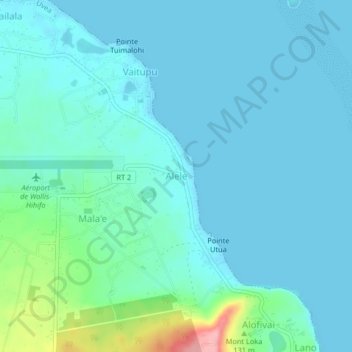
Name: Alele topographic map, elevation, terrain.

Location: Alele, Uvea, Wallis and Futuna, 98600, France (-13.25966 -176.20217 -13.21966 -176.16217)

Average elevation: 19 m

Minimum elevation: 0 m

Maximum elevation: 128 m

Gear up for your next adventure:

💡Solar Camping Lamp - Eco-friendly lighting for campsites
💧Filtered Water Bottle - Safe drinking water on the go
🧢Sun Hat - Wide-brim hat for sun protection
🥾Light Trekking Boots - Supportive boots for multi-day treks
🗺️Topographic Maps - Detailed maps to explore trails, mountains, and wilderness areas

As an Amazon Associate, this site earns from qualifying purchases at no extra cost to you.