
Thank you for supporting this site ❤️
Make a donation
Make a donation
Gear up for your next adventure:
As an Amazon Associate, this site earns from qualifying purchases at no extra cost to you.
Carvalhelhos topographic map
Click on the map to display elevation.
Thank you for supporting this site ❤️
Make a donation
Make a donation
Gear up for your next adventure:
As an Amazon Associate, this site earns from qualifying purchases at no extra cost to you.
About this map
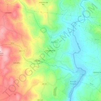
Name: Carvalhelhos topographic map, elevation, terrain.
Location: Carvalhelhos, Beça, Boticas, Vila Real, 5460-120, Portugal (41.67029 -7.74901 41.71029 -7.70901)
Average elevation: 836 m
Minimum elevation: 720 m
Maximum elevation: 1,008 m
Thank you for supporting this site ❤️
Make a donation
Make a donation
Gear up for your next adventure:
As an Amazon Associate, this site earns from qualifying purchases at no extra cost to you.