

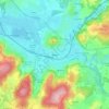
Montcey topographic map
Click on the map to display elevation.
Montcey
Le territoire communal s'étend sur 8,12 km2, avec une altitude minimale de 282 mètres et une altitude maximale de 400 mètres.
About this map

Name: Montcey topographic map, elevation, terrain.
Average elevation: 315 m
Minimum elevation: 225 m
Maximum elevation: 395 m
Other topographic maps
Click on a map to view its topography, its elevation and its terrain.

La Bachetey
France > Bourgogne-Franche-Comté > Haute-Saône > Beulotte-Saint-Laurent > La Bachetey
Average elevation: 660 m

Fougerolles
France > Bourgogne-Franche-Comté > Haute-Saône > Fougerolles-Saint-Valbert
Average elevation: 340 m


Athesans
France > Bourgogne-Franche-Comté > Haute-Saône > Athesans-Étroitefontaine
Average elevation: 300 m


Le Sabot
France > Bourgogne-Franche-Comté > Haute-Saône > Frotey-lès-Vesoul > Le Sabot
Average elevation: 257 m


La Goutte
France > Bourgogne-Franche-Comté > Haute-Saône > Mailleroncourt-Charette
Average elevation: 279 m


Pré Boichey
France > Bourgogne-Franche-Comté > Haute-Saône > Servance-Miellin
Average elevation: 563 m


Champagney - Le Bas des Côtes
France > Bourgogne-Franche-Comté > Haute-Saône > Champagney
Average elevation: 392 m


Les Bastiens
France > Bourgogne-Franche-Comté > Haute-Saône > Saint-Bresson > Les Bastiens
Average elevation: 543 m


Le Petit Fahys
France > Bourgogne-Franche-Comté > Haute-Saône > Fougerolles-Saint-Valbert
Average elevation: 367 m


Château de Fondremand
France > Bourgogne-Franche-Comté > Haute-Saône > Fondremand
Average elevation: 322 m

Le Pont Vautey
France > Bourgogne-Franche-Comté > Haute-Saône > Faucogney-et-la-Mer > Le Pont Vautey
Average elevation: 454 m

Le Voirmet
France > Bourgogne-Franche-Comté > Haute-Saône > Servance-Miellin > Miellin
Average elevation: 796 m

Le Grilloux
France > Bourgogne-Franche-Comté > Haute-Saône > Servance-Miellin > Le Grilloux
Average elevation: 587 m

La Clairegoutte
France > Bourgogne-Franche-Comté > Haute-Saône > Clairegoutte
Average elevation: 348 m


Servance
France > Bourgogne-Franche-Comté > Haute-Saône > Servance-Miellin > Servance
Average elevation: 527 m


Noroy-lès-Jussey
France > Bourgogne-Franche-Comté > Haute-Saône > Jussey > Noroy-lès-Jussey
Average elevation: 267 m

Velesmes
France > Bourgogne-Franche-Comté > Haute-Saône > Velesmes-Échevanne > Velesmes
Average elevation: 222 m

La Goulotte
France > Bourgogne-Franche-Comté > Haute-Saône > Mélisey > La Goulotte
Average elevation: 349 m


Miserey
France > Bourgogne-Franche-Comté > Haute-Saône > Calmoutier > Miserey
Average elevation: 303 m

Les Évaudois
France > Bourgogne-Franche-Comté > Haute-Saône > Servance-Miellin > Les Évaudois
Average elevation: 549 m

Le Fahys
France > Bourgogne-Franche-Comté > Haute-Saône > Saint-Bresson > Le Fahys
Average elevation: 509 m


Montseugny
France > Bourgogne-Franche-Comté > Haute-Saône > Broye-Aubigney-Montseugny > Montseugny
Average elevation: 215 m

L'Enclose du Monthury
France > Bourgogne-Franche-Comté > Haute-Saône > Servance-Miellin
Average elevation: 576 m


Planche des Belles Filles
France > Bourgogne-Franche-Comté > Haute-Saône > Plancher-les-Mines
Average elevation: 860 m


Viaux les Champs
France > Bourgogne-Franche-Comté > Haute-Saône > Esmoulières
Average elevation: 572 m

Blanzey
France > Bourgogne-Franche-Comté > Haute-Saône > Fougerolles-Saint-Valbert
Average elevation: 389 m


Echevanne
France > Bourgogne-Franche-Comté > Haute-Saône > Velesmes-Échevanne
Average elevation: 225 m

Les Sept Fontaines
France > Bourgogne-Franche-Comté > Haute-Saône > La Vernotte
Average elevation: 231 m


Les Tournières
France > Bourgogne-Franche-Comté > Haute-Saône > Charmes-Saint-Valbert
Average elevation: 325 m

Nervezain
France > Bourgogne-Franche-Comté > Haute-Saône > Vauconcourt-Nervezain
Average elevation: 244 m

Maison du Bois
France > Bourgogne-Franche-Comté > Haute-Saône > Amblans-et-Velotte
Average elevation: 317 m


Broye-lès-Pesmes
France > Bourgogne-Franche-Comté > Haute-Saône > Broye-Aubigney-Montseugny
Average elevation: 193 m

Montelimard
France > Bourgogne-Franche-Comté > Haute-Saône > Dampierre-sur-Linotte > Les Grillardes
Average elevation: 330 m

Magny Maubert
France > Bourgogne-Franche-Comté > Haute-Saône > Servance-Miellin
Average elevation: 577 m

Broye-les-Loups
France > Bourgogne-Franche-Comté > Haute-Saône > Broye-les-Loups-et-Verfontaine
Average elevation: 234 m

Crevans
France > Bourgogne-Franche-Comté > Haute-Saône > Crevans-et-la-Chapelle-lès-Granges
Average elevation: 344 m

Les Forges
France > Bourgogne-Franche-Comté > Haute-Saône > Raddon-et-Chapendu
Average elevation: 421 m

Courbenans
France > Bourgogne-Franche-Comté > Haute-Saône > Vellechevreux-et-Courbenans
Average elevation: 376 m


Fort de Château-Lambert
France > Bourgogne-Franche-Comté > Haute-Saône > Haut-du-Them-Château-Lambert
Average elevation: 674 m


Les Breuchots
France > Bourgogne-Franche-Comté > Haute-Saône > Servance-Miellin
Average elevation: 564 m


They-en-Sorans
France > Bourgogne-Franche-Comté > Haute-Saône > Sorans-lès-Breurey
Average elevation: 258 m

La Fonderie
France > Bourgogne-Franche-Comté > Haute-Saône > Haut-du-Them-Château-Lambert
Average elevation: 796 m


Vellexon
France > Bourgogne-Franche-Comté > Haute-Saône > Vellexon-Queutrey-et-Vaudey
Average elevation: 217 m


Lieu-dit Moulin des Bois
France > Bourgogne-Franche-Comté > Haute-Saône > Calmoutier
Average elevation: 330 m


Longevelle
France > Bourgogne-Franche-Comté > Haute-Saône > Vantoux-et-Longevelle
Average elevation: 243 m


Ternuay
France > Bourgogne-Franche-Comté > Haute-Saône > Ternuay-Melay-et-Saint-Hilaire
Average elevation: 456 m

Les Chavannes
France > Bourgogne-Franche-Comté > Haute-Saône > Fougerolles-Saint-Valbert
Average elevation: 305 m


Magny Vernois Gare
France > Bourgogne-Franche-Comté > Haute-Saône > Magny-Vernois
Average elevation: 293 m


Le Lyaumont
France > Bourgogne-Franche-Comté > Haute-Saône > Aillevillers-et-Lyaumont
Average elevation: 354 m

La Grange de la Vigne
France > Bourgogne-Franche-Comté > Haute-Saône > Vouhenans
Average elevation: 292 m


