
Thank you for supporting this site ❤️
Make a donation
Make a donation
Gear up for your next adventure:
As an Amazon Associate, this site earns from qualifying purchases at no extra cost to you.
Kremmling topographic map
Click on the map to display elevation.
Thank you for supporting this site ❤️
Make a donation
Make a donation
Gear up for your next adventure:
As an Amazon Associate, this site earns from qualifying purchases at no extra cost to you.
About this map
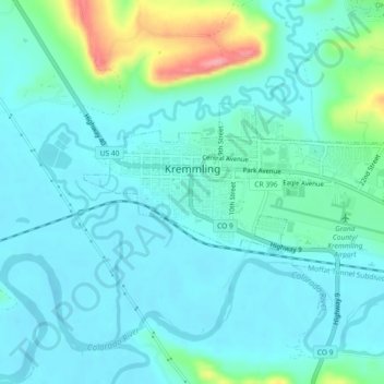
Name: Kremmling topographic map, elevation, terrain.
Location: Kremmling, Grand County, Colorado, 80459, United States (40.04836 -106.40161 40.06475 -106.35584)
Average elevation: 2,251 m
Minimum elevation: 2,231 m
Maximum elevation: 2,338 m
Thank you for supporting this site ❤️
Make a donation
Make a donation
Gear up for your next adventure:
As an Amazon Associate, this site earns from qualifying purchases at no extra cost to you.