Geolocate

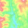
Powder House Pass topographic map

Click on the map to display elevation.

About this map

Name: Powder House Pass topographic map, elevation, terrain.

Location: Powder House Pass, Lawrence County, South Dakota, United States (44.28763 -103.82518 44.32739 -103.78457)

Average elevation: 1,806 m

Minimum elevation: 1,647 m

Maximum elevation: 2,027 m

Other topographic maps

Click on a map to view its topography, its elevation and its terrain.
Nemo

United States > South Dakota > Lawrence County

Average elevation: 1,490 m

Trojan

United States > South Dakota > Lawrence County

Average elevation: 1,880 m

Nahant

United States > South Dakota > Lawrence County

Average elevation: 1,806 m

Terry Peak

United States > South Dakota > Lawrence County

Average elevation: 1,940 m

Merritt

United States > South Dakota > Lawrence County

Average elevation: 1,601 m

Spearfish

United States > South Dakota > Lawrence County > Spearfish

Average elevation: 1,291 m

Gear up for your next adventure:

🕶️Polarized Sunglasses - Reduces glare from snow and water at high elevations
🎒Hiking Backpack - Lightweight and ergonomic backpacks for day hikes or multi-day treks
🔦LED Flashlight - Powerful and long-lasting flashlight for camping and emergencies
🦶Hiking Shoe Insoles - Added support for high arches and long days on feet
🔪Outdoor Multitool - Versatile tool for repairs and food prep in the wild

As an Amazon Associate, this site earns from qualifying purchases at no extra cost to you.