
Jerzmanowice topographic map
Interactive map
Click on the map to display elevation.
About this map
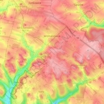
Name: Jerzmanowice topographic map, elevation, terrain.
Average elevation: 447 m
Minimum elevation: 345 m
Maximum elevation: 495 m
Other topographic maps
Click on a map to view its topography, its elevation and its terrain.
Libertów
Poland > Lesser Poland Voivodeship > Kraków County > Libertów
Libertów, gmina Mogilany, Kraków County, Lesser Poland Voivodeship, 30-444, Poland
Average elevation: 270 m
Liszki
Poland > Lesser Poland Voivodeship > Kraków County > Liszki
Liszki, gmina Liszki, Kraków County, Lesser Poland Voivodeship, 32-060, Poland
Average elevation: 232 m