Geolocate

Sobreda topographic map

Click on the map to display elevation.

About this map

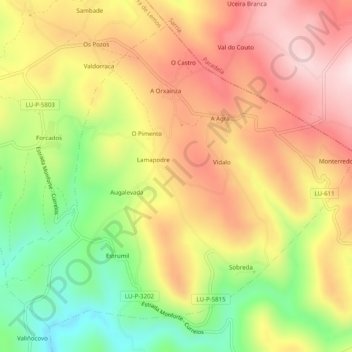
Name: Sobreda topographic map, elevation, terrain.

Location: Sobreda, O Saviñao, Tierra de Lemos, Lugo, Galicia, España (42.66388 -7.62890 42.69521 -7.57921)

Average elevation: 655 m

Minimum elevation: 459 m

Maximum elevation: 823 m

Other topographic maps

Click on a map to view its topography, its elevation and its terrain.

Escairón

España > Galicia > Tierra de Lemos > O Saviñao

Average elevation: 587 m

Currelos

España > Galicia > Tierra de Lemos > O Saviñao

Average elevation: 543 m

Souceda

España > Galicia > Tierra de Lemos > O Saviñao > Souceda

Average elevation: 662 m

Gear up for your next adventure:

🧥Softshell Hiking Jacket - The perfect balance of wind protection and breathability
🔋Emergency Crank Radio - Weather alerts and power without needing batteries
🎒Backpack Rain Cover - External shield to keep your entire pack dry
🎒Hiking Daypack - Lightweight and durable backpacks for day trips and excursions
🥾Light Trekking Boots - Supportive boots for multi-day treks

As an Amazon Associate, this site earns from qualifying purchases at no extra cost to you.