Geolocate

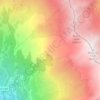
La Traversaz topographic map

Click on the map to display elevation.

About this map

Name: La Traversaz topographic map, elevation, terrain.

Location: La Traversaz, Saint-Michel-de-Maurienne, Saint-Jean-de-Maurienne, Savoie, Auvergne-Rhône-Alpes, France métropolitaine, 73140, France (45.21263 6.46150 45.25263 6.50150)

Average elevation: 1,310 m

Minimum elevation: 697 m

Maximum elevation: 2,317 m

Other topographic maps

Click on a map to view its topography, its elevation and its terrain.
Gear up for your next adventure:

🧥Insulated Jacket - Keep warm in cold outdoor conditions
🧰Multitool Knife - Compact and versatile tool for outdoor use
⛺Camping Groundsheet - Protect your tent from moisture and dirt
🎒Hiking Backpack - Lightweight and ergonomic backpacks for day hikes or multi-day treks
🧣Merino Neck Gaiter - Protects against wind, sun, and cold at high altitudes

As an Amazon Associate, this site earns from qualifying purchases at no extra cost to you.