Geolocate

Ocotepeque topographic map

Click on the map to display elevation.

About this map
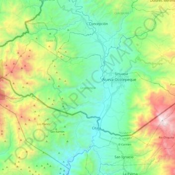
Name: Ocotepeque topographic map, elevation, terrain.

Location: Ocotepeque, Honduras (14.36475 -89.33427 14.48581 -89.10863)

Average elevation: 1,250 m

Minimum elevation: 637 m

Maximum elevation: 2,704 m

Gear up for your next adventure:

🧊Portable Cooler - Keep food and drinks cold during outdoor adventures
🔋Emergency Crank Radio - Weather alerts and power without needing batteries
🔦LED Flashlight - Powerful and long-lasting flashlight for camping and emergencies
🥾Hiking Shoes - Durable and comfortable shoes for trail hiking
🥾Hiking Leggings - Comfortable leggings for outdoor activities

As an Amazon Associate, this site earns from qualifying purchases at no extra cost to you.