
Clonmany Civil Parish topographic map
Interactive map
Click on the map to display elevation.
About this map
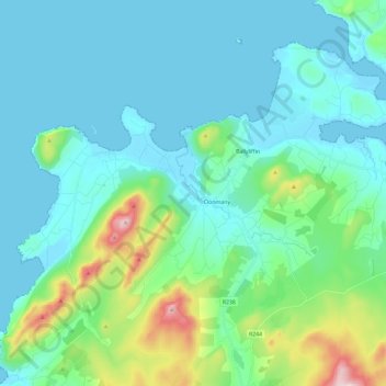
Name: Clonmany Civil Parish topographic map, elevation, terrain.
Location: Clonmany Civil Parish, County Donegal, Ulster, Irlande (55.21248 -7.53918 55.31929 -7.30383)
Average elevation: 92 m
Minimum elevation: -1 m
Maximum elevation: 530 m
Other topographic maps
Click on a map to view its topography, its elevation and its terrain.
Donegal Municipal District
Donegal Municipal District, County Donegal, Ulster, Irlande
Average elevation: 120 m
Letterkenny Municipal District
Letterkenny Municipal District, County Donegal, Ulster, Irlande
Average elevation: 92 m
Glencolumbkille
Glencolumbkille, County Donegal, Irlande
Average elevation: 95 m
Illion
Illion, Aran ED, Glenties Municipal District, County Donegal, Irlande
Average elevation: 59 m
Clonmany
Irlande > County Donegal > Clonmany
Clonmany, Inishowen Municipal District, County Donegal, F93 RRX6, Irlande
Average elevation: 70 m