
Yola topographic map
Interactive map
Click on the map to display elevation.
About this map
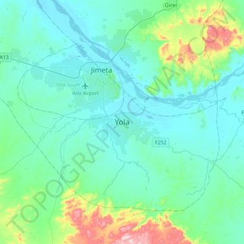
Name: Yola topographic map, elevation, terrain.
Location: Yola, Yola North, Adamawa State, Nigeria (9.04893 12.32025 9.36893 12.64025)
Average elevation: 242 m
Minimum elevation: 149 m
Maximum elevation: 744 m
Other topographic maps
Click on a map to view its topography, its elevation and its terrain.
Mayel Kohi
Nigeria > Adamawa State > Yola North
Mayel Kohi, Yola North, Adamawa State, Nigeria
Average elevation: 211 m