
Ruen topographic map
Interactive map
Click on the map to display elevation.
About this map
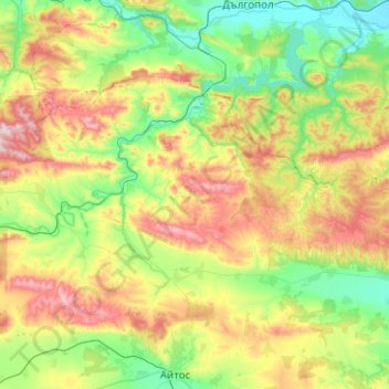
Name: Ruen topographic map, elevation, terrain.
Location: Ruen, Burgas, Bulgaria (42.75171 27.01327 42.98470 27.51295)
Average elevation: 258 m
Minimum elevation: 21 m
Maximum elevation: 726 m
Other topographic maps
Click on a map to view its topography, its elevation and its terrain.