Geolocate

Cambridge topographic map

Click on the map to display elevation.

About this map

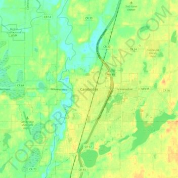
Name: Cambridge topographic map, elevation, terrain.

Location: Cambridge, Isanti County, Minnesota, 55008, United States (45.53274 -93.26439 45.61274 -93.18439)

Average elevation: 289 m

Minimum elevation: 273 m

Maximum elevation: 305 m

Gear up for your next adventure:

🥾Trail Hiking Socks - Comfortable socks to prevent blisters and fatigue
🧦Crew Hiking Socks - Comfortable socks for long-distance hikes
👟Sport Hiking Sandals - Breathable footwear for water crossings and camp rest
🧥Packable Rain Jacket - Breathable waterproof layer for unpredictable weather
🚲MTB Frame Bag - Carry tools and maps directly on your bicycle frame

As an Amazon Associate, this site earns from qualifying purchases at no extra cost to you.