Geolocate

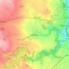
Pchery topographic map

Click on the map to display elevation.

About this map

Name: Pchery topographic map, elevation, terrain.

Location: Pchery, okres Kladno, Central Bohemia, 273 08, Czechia (50.17719 14.09893 50.20495 14.14900)

Average elevation: 317 m

Minimum elevation: 235 m

Maximum elevation: 389 m

Other topographic maps

Click on a map to view its topography, its elevation and its terrain.

Talmberg Castle

Czechia > Central Bohemia > Talmberk

Average elevation: 405 m

Bylany

Czechia > Central Bohemia

Average elevation: 323 m

Břve

Czechia > Central Bohemia > Hostivice

Average elevation: 371 m

Mysletice

Czechia > Central Bohemia > Votice

Average elevation: 600 m

Tůmovka

Czechia > Central Bohemia > Předboj

Average elevation: 201 m

Gear up for your next adventure:

🔋Lithium AA Batteries - Long-lasting power that performs in extreme cold
🛶Waterproof Dry Bags - Keep electronics and clothes dry during river crossings
🩹Moleskin Blister Pads - Direct protection for painful foot pressure points
🔭Outdoor Binoculars - Lightweight binoculars for birdwatching and hiking
🧢Hiking Hat - Sun-protective and breathable hats for long treks

As an Amazon Associate, this site earns from qualifying purchases at no extra cost to you.