
Thank you for supporting this site ❤️
Make a donation
Make a donation
Gear up for your next adventure:
As an Amazon Associate, this site earns from qualifying purchases at no extra cost to you.
Valleluce topographic map
Click on the map to display elevation.
Thank you for supporting this site ❤️
Make a donation
Make a donation
Gear up for your next adventure:
As an Amazon Associate, this site earns from qualifying purchases at no extra cost to you.
About this map
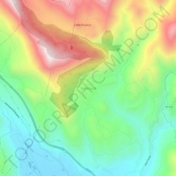
Name: Valleluce topographic map, elevation, terrain.
Location: Valleluce, Sant'Elia Fiumerapido, Frosinone, Lazio, Italia (41.54638 13.83710 41.58638 13.87710)
Average elevation: 408 m
Minimum elevation: 75 m
Maximum elevation: 919 m
Thank you for supporting this site ❤️
Make a donation
Make a donation
Gear up for your next adventure:
As an Amazon Associate, this site earns from qualifying purchases at no extra cost to you.