Geolocate

Mollseifen topographic map

Click on the map to display elevation.

About this map
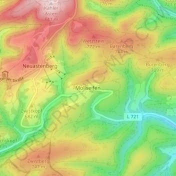
Name: Mollseifen topographic map, elevation, terrain.

Location: Mollseifen, Winterberg, Hochsauerlandkreis, Noordrijn-Westfalen, Duitsland (51.13998 8.48254 51.17998 8.52254)

Average elevation: 662 m

Minimum elevation: 497 m

Maximum elevation: 844 m

Other topographic maps

Click on a map to view its topography, its elevation and its terrain.

Gear up for your next adventure:

💧Collapsible Water Bottle - Space-saving water bottle for outdoor activities
🥾Trekking Poles - Adjustable trekking poles to reduce knee stress and improve stability
🧭GPS Outdoor Watch - Smart watch for navigation and fitness tracking in nature
🪜Heavy Duty Carabiners - Multi-use clips for securing gear to your backpack
🥾Hiking Boots - Sturdy boots providing ankle support and traction on rugged trails

As an Amazon Associate, this site earns from qualifying purchases at no extra cost to you.