Geolocate

Parksley topographic map

Click on the map to display elevation.

About this map

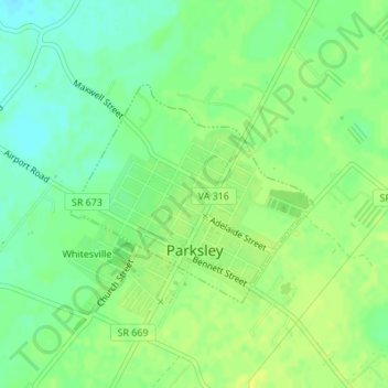
Name: Parksley topographic map, elevation, terrain.

Location: Parksley, Accomack County, Virginia, United States (37.77905 -75.66429 37.79410 -75.64277)

Average elevation: 11 m

Minimum elevation: 1 m

Maximum elevation: 18 m

Other topographic maps

Click on a map to view its topography, its elevation and its terrain.

Hacksneck

United States > Virginia > Accomack County

Average elevation: 1 m

The Notch

United States > Virginia > Accomack County

Average elevation: 2 m

Oak Hall

United States > Virginia > Accomack County

It lies at an elevation of 26 feet.

Average elevation: 10 m

Deep Creek

United States > Virginia > Accomack County

Average elevation: 1 m

Upper Tump

United States > Virginia > Accomack County

Average elevation: 0 m

Gear up for your next adventure:

🚲Handlebar Phone Mount - View topographic-map.com live while cycling
💡LED Headlamp - Hands-free illumination for night hiking and camping
🥾Trail Hiking Socks - Comfortable socks to prevent blisters and fatigue
🥾Hiking Boots - Sturdy boots providing ankle support and traction on rugged trails
🧦Hiking Liner Socks - Thin base layer to prevent friction and blisters

As an Amazon Associate, this site earns from qualifying purchases at no extra cost to you.