Geolocate

Sobea Inner topographic map

Click on the map to display elevation.

About this map

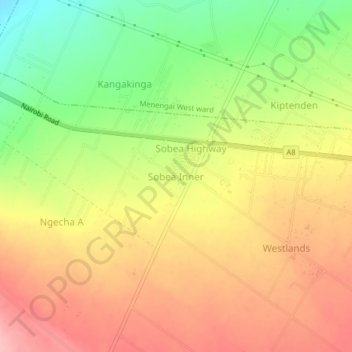
Name: Sobea Inner topographic map, elevation, terrain.

Location: Sobea Inner, Mosop ward, Rongai, Nakuru, Kenya (-0.26968 35.91860 -0.22968 35.95860)

Average elevation: 2,066 m

Minimum elevation: 1,993 m

Maximum elevation: 2,124 m

Gear up for your next adventure:

🥾Trail Running Shoes - Lightweight and durable shoes for trail running
🛶Waterproof Dry Bags - Keep electronics and clothes dry during river crossings
🧭Orienteering Kit - Tools for map reading and navigation in the wild
🧭GPS Outdoor Watch - Smart watch for navigation and fitness tracking in nature
🧦Hiking Socks - Moisture-wicking and comfortable socks for long hikes

As an Amazon Associate, this site earns from qualifying purchases at no extra cost to you.