Geolocate

Punta Prieta topographic map

Click on the map to display elevation.

About this map

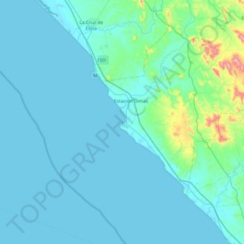
Name: Punta Prieta topographic map, elevation, terrain.

Location: Punta Prieta, San Ignacio, Sinaloa, Mexico (23.34748 -107.12382 23.98748 -106.48382)

Average elevation: 53 m

Minimum elevation: -1 m

Maximum elevation: 710 m

Gear up for your next adventure:

🧣Merino Neck Gaiter - Protects against wind, sun, and cold at high altitudes
🥾Light Hiking Boots - Lightweight and comfortable boots for day hikes
🥾Hiking Leggings - Comfortable leggings for outdoor activities
🥾Approach Boots - Comfortable boots for hiking and climbing approaches
🦶Anti-Blister Balm - Prevents friction and hotspots during long ascents

As an Amazon Associate, this site earns from qualifying purchases at no extra cost to you.