
Thank you for supporting this site ❤️
Make a donation
Make a donation
Gear up for your next adventure:
As an Amazon Associate, this site earns from qualifying purchases at no extra cost to you.
Platanal topographic map
Click on the map to display elevation.
Thank you for supporting this site ❤️
Make a donation
Make a donation
Gear up for your next adventure:
As an Amazon Associate, this site earns from qualifying purchases at no extra cost to you.
About this map
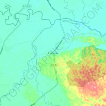
Name: Platanal topographic map, elevation, terrain.
Location: Platanal, Cotuí, Sánchez Ramírez, Dominican Republic (19.08852 -70.13924 19.16852 -70.05924)
Average elevation: 46 m
Minimum elevation: 15 m
Maximum elevation: 148 m
Thank you for supporting this site ❤️
Make a donation
Make a donation
Gear up for your next adventure:
As an Amazon Associate, this site earns from qualifying purchases at no extra cost to you.