Geolocate

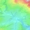
Le Gojat topographic map

Click on the map to display elevation.

About this map

Name: Le Gojat topographic map, elevation, terrain.

Location: Le Gojat, Novalaise, Chambéry, Savoie, Auvergne-Rhône-Alpes, France métropolitaine, 73470, France (45.54175 5.77111 45.58175 5.81111)

Average elevation: 463 m

Minimum elevation: 367 m

Maximum elevation: 1,012 m

Other topographic maps

Click on a map to view its topography, its elevation and its terrain.
73470

France > Auvergne-Rhône-Alpes > Savoie > Novalaise > Carabin

Average elevation: 491 m

Gear up for your next adventure:

🥾Light Trekking Boots - Supportive boots for multi-day treks
⛺Lightweight Camping Tent - Portable shelter optimized for Canadian backcountry camping
🔪Outdoor Multitool - Versatile tool for repairs and food prep in the wild
🥾Hiking Gaiters - Protect legs and shoes from mud, snow, and debris
🔭Outdoor Binoculars - Lightweight binoculars for birdwatching and hiking

As an Amazon Associate, this site earns from qualifying purchases at no extra cost to you.