Geolocate

Marmore topographic map

Click on the map to display elevation.

About this map

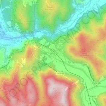
Name: Marmore topographic map, elevation, terrain.

Location: Marmore, Terni, Umbria, 05100, Italy (42.52695 12.69483 42.56695 12.73483)

Average elevation: 435 m

Minimum elevation: 164 m

Maximum elevation: 766 m

Gear up for your next adventure:

🥾Approach Boots - Comfortable boots for hiking and climbing approaches
🧥Fleece Jacket - Warm and lightweight jacket for layering
🩹Moleskin Blister Pads - Direct protection for painful foot pressure points
🥤Collapsible Travel Cup - Saves space and weight in your mess kit
🔥Camping Stove - Portable stoves to cook outdoors with ease

As an Amazon Associate, this site earns from qualifying purchases at no extra cost to you.