Geolocate

Puca Puca topographic map

Click on the map to display elevation.

About this map

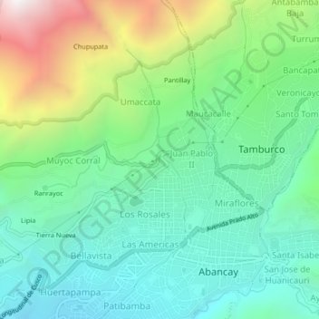
Name: Puca Puca topographic map, elevation, terrain.

Location: Puca Puca, Abancay, Apurímac, Perú (-13.64334 -72.90647 -13.60334 -72.86647)

Average elevation: 2,683 m

Minimum elevation: 2,211 m

Maximum elevation: 3,796 m

Gear up for your next adventure:

🚑Survival Whistle - Signal for help across long distances in mountains
💡Compact LED Flashlight - Powerful and portable flashlight for outdoor use
🗺️Topographic Maps - Detailed maps to explore trails, mountains, and wilderness areas
🧰Multitool Knife - Compact and versatile tool for outdoor use
🧤Thermal Hiking Gloves - Grip-enhanced gloves for cold-weather altitude trekking

As an Amazon Associate, this site earns from qualifying purchases at no extra cost to you.