Geolocate

Kukuh topographic map

Click on the map to display elevation.

About this map

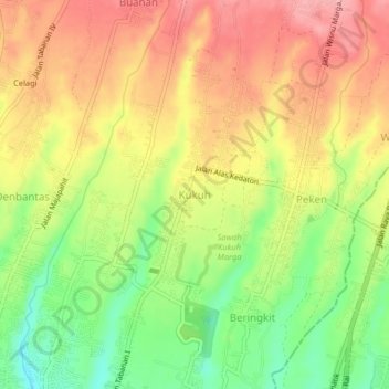
Name: Kukuh topographic map, elevation, terrain.

Location: Kukuh, Tabanan, Bali, Lesser Sunda Islands, Indonesia (-8.53613 115.13535 -8.49613 115.17535)

Average elevation: 166 m

Minimum elevation: 104 m

Maximum elevation: 218 m

Other topographic maps

Click on a map to view its topography, its elevation and its terrain.

Nuanu Creative City

Indonesia > Bali > Tabanan > Beraban

Average elevation: 14 m

Gear up for your next adventure:

🧥Packable Rain Jacket - Breathable waterproof layer for unpredictable weather
🔦UV Flashlight - Detect minerals or specific insects in the dark
🥘Camping Cookware Set - Compact nesting pots and pans for trail cooking
Family Camping Tent - Spacious tent suitable for family camping trips
🥾Trail Hiking Boots - Supportive boots for rough trails

As an Amazon Associate, this site earns from qualifying purchases at no extra cost to you.