
Make a donation
Gear up for your next adventure:
As an Amazon Associate, this site earns from qualifying purchases at no extra cost to you.
Poissons topographic map
Click on the map to display elevation.
Make a donation
Gear up for your next adventure:
As an Amazon Associate, this site earns from qualifying purchases at no extra cost to you.
About this map
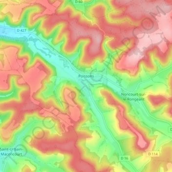
Name: Poissons topographic map, elevation, terrain.
Average elevation: 305 m
Minimum elevation: 195 m
Maximum elevation: 397 m
Make a donation
Gear up for your next adventure:
As an Amazon Associate, this site earns from qualifying purchases at no extra cost to you.
Other topographic maps
Click on a map to view its topography, its elevation and its terrain.
Val Meunier
France > Grand Est > Haute-Marne > Froncles > La Ferme de Brouville
Average elevation: 276 m
Le Champ Métret
France > Grand Est > Haute-Marne > Perrancey-les-Vieux-Moulins > La Ville Neuve
Average elevation: 413 m
Chaumont
France > Grand Est > Haute-Marne > Chaumont > Chaumont
Commentaires (en ligne) de Cl. Richier sur l'étymologie de Chaumont. L’étymologie de Chaumont calvus mons soit le « Mont Chauve ». Le terme renvoie au site dépouillé d'arbre sur lequel la première ville a été édifiée au Xe siècle : un éperon abrupt et une terre de pâture estivale qui dominent…
Average elevation: 309 m
Make a donation
Gear up for your next adventure:
As an Amazon Associate, this site earns from qualifying purchases at no extra cost to you.
Le Châtelet-sur-Meuse
France > Grand Est > Haute-Marne > Le Châtelet-sur-Meuse > Le Châtelet-sur-Meuse
Average elevation: 398 m