
Thank you for supporting this site ❤️
Make a donation
Make a donation
Gear up for your next adventure:
As an Amazon Associate, this site earns from qualifying purchases at no extra cost to you.
Stainach topographic map
Click on the map to display elevation.
Thank you for supporting this site ❤️
Make a donation
Make a donation
Gear up for your next adventure:
As an Amazon Associate, this site earns from qualifying purchases at no extra cost to you.
About this map
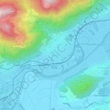
Name: Stainach topographic map, elevation, terrain.
Location: Stainach, Stainach-Pürgg, Bezirk Liezen, Styria, 8950, Austria (47.51243 14.08761 47.55243 14.12761)
Average elevation: 799 m
Minimum elevation: 632 m
Maximum elevation: 1,473 m
Thank you for supporting this site ❤️
Make a donation
Make a donation
Gear up for your next adventure:
As an Amazon Associate, this site earns from qualifying purchases at no extra cost to you.