
Thank you for supporting this site ❤️
Make a donation
Make a donation
Gear up for your next adventure:
As an Amazon Associate, this site earns from qualifying purchases at no extra cost to you.
Fonteita topographic map
Click on the map to display elevation.
Thank you for supporting this site ❤️
Make a donation
Make a donation
Gear up for your next adventure:
As an Amazon Associate, this site earns from qualifying purchases at no extra cost to you.
About this map
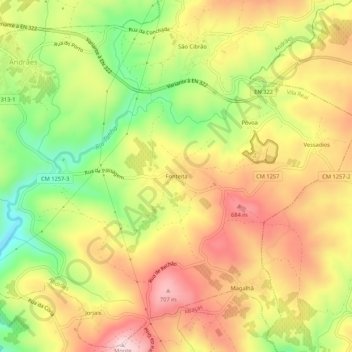
Name: Fonteita topographic map, elevation, terrain.
Location: Fonteita, Andrães, Vila Real, 5000-037, Portugal (41.23379 -7.68478 41.27379 -7.64478)
Average elevation: 580 m
Minimum elevation: 417 m
Maximum elevation: 720 m
Thank you for supporting this site ❤️
Make a donation
Make a donation
Gear up for your next adventure:
As an Amazon Associate, this site earns from qualifying purchases at no extra cost to you.