Geolocate

Huavalito topographic map

Click on the map to display elevation.

About this map

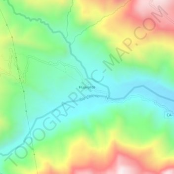
Name: Huavalito topographic map, elevation, terrain.

Location: Huavalito, Cachachi, Cajabamba, Cajamarca, Perú (-7.55318 -78.26244 -7.51318 -78.22244)

Average elevation: 2,458 m

Minimum elevation: 2,147 m

Maximum elevation: 3,007 m

Gear up for your next adventure:

🥾Trail Running Shoes - Lightweight and durable shoes for trail running
🔋Solar Power Bank - Keep your GPS and devices charged during long outdoor trips
🥽Outdoor Goggles - Protective eyewear for outdoor activities
🚲MTB Frame Bag - Carry tools and maps directly on your bicycle frame
🧴Outdoor Sunscreen - High SPF protection for high-altitude UV exposure

As an Amazon Associate, this site earns from qualifying purchases at no extra cost to you.