Geolocate

Hengdian topographic map

Click on the map to display elevation.

About this map

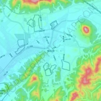
Name: Hengdian topographic map, elevation, terrain.

Location: Hengdian, Jinhua, Zhejiang, 322118, China (29.11475 120.27124 29.19475 120.35124)

Average elevation: 177 m

Minimum elevation: 106 m

Maximum elevation: 502 m

Gear up for your next adventure:

🛶Waterproof Dry Bags - Keep electronics and clothes dry during river crossings
🛌Down Sleeping Bag - Superior warmth-to-weight ratio for cold nights
🕶️Polarized Sunglasses - Reduces glare from snow and water at high elevations
🧶550 Survival Paracord - Versatile utility cord for emergency repairs and rigging
🥾All-Terrain Hiking Boots - Versatile boots for varied hiking conditions

As an Amazon Associate, this site earns from qualifying purchases at no extra cost to you.