Geolocate

Austinville topographic map

Click on the map to display elevation.

About this map

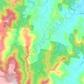
Name: Austinville topographic map, elevation, terrain.

Location: Austinville, Gold Coast City, Queensland, Australia (-28.19988 153.28840 -28.11408 153.33423)

Average elevation: 241 m

Minimum elevation: 21 m

Maximum elevation: 664 m

Other topographic maps

Click on a map to view its topography, its elevation and its terrain.

Swan Lake

Australia > Queensland > Gold Coast City

Average elevation: 6 m

Gorge Falls

Australia > Queensland > Gold Coast City

Average elevation: 341 m

Mount Nathan

Australia > Queensland > Gold Coast City

Average elevation: 121 m

Gear up for your next adventure:

🦯Trekking Poles - Reduced impact on joints for steep topographic climbs
🧥Waterproof Jacket - Lightweight rain jackets for hiking and outdoor activities
💧Filtered Water Bottle - Safe drinking water on the go
🧢Outdoor Cap - Protective cap for sun and rain during hikes
🛶Kayak Accessories - Essential gear for safe and fun kayaking adventures

As an Amazon Associate, this site earns from qualifying purchases at no extra cost to you.