Geolocate

Mombercelli topographic map

Click on the map to display elevation.

About this map

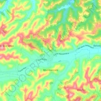
Name: Mombercelli topographic map, elevation, terrain.

Location: Mombercelli, Asti, Piedmont, Italy (44.80153 8.27009 44.85407 8.32719)

Average elevation: 188 m

Minimum elevation: 125 m

Maximum elevation: 279 m

Other topographic maps

Click on a map to view its topography, its elevation and its terrain.

Zolfo

Italy > Piedmont > Asti > Montafia

Average elevation: 226 m

Gear up for your next adventure:

Camping Coffee Maker - Brew fresh coffee anywhere on the topographic map
🧳Compression Sacks - Maximize space in your backpack by shrinking gear
Camping Essentials - All-in-one gear for a comfortable camping trip
🧥Softshell Jacket - Windproof and breathable jacket for hiking
🏃Hydration Running Vest - Carry water and maps close to your body for speed

As an Amazon Associate, this site earns from qualifying purchases at no extra cost to you.