Geolocate

Rio Verde topographic map

Click on the map to display elevation.

About this map

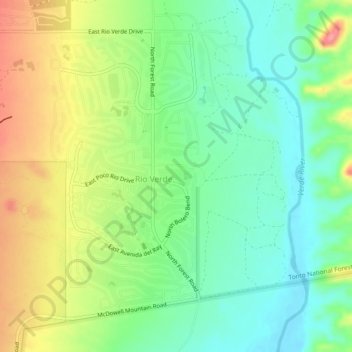
Name: Rio Verde topographic map, elevation, terrain.

Location: Rio Verde, Maricopa County, Arizona, 85263, United States (33.70939 -111.69994 33.74158 -111.65324)

Average elevation: 484 m

Minimum elevation: 448 m

Maximum elevation: 540 m

Gear up for your next adventure:

💧Hydration Bladder - Hands-free hydration solution for long treks
🥾Hiking Leggings - Comfortable leggings for outdoor activities
🧢Outdoor Cap - Protective cap for sun and rain during hikes
🚲Handlebar Phone Mount - View topographic-map.com live while cycling
🧦Hiking Liner Socks - Thin base layer to prevent friction and blisters

As an Amazon Associate, this site earns from qualifying purchases at no extra cost to you.