
Make a donation
Gear up for your next adventure:
As an Amazon Associate, this site earns from qualifying purchases at no extra cost to you.
Castel San Felice topographic map
Click on the map to display elevation.
Make a donation
Gear up for your next adventure:
As an Amazon Associate, this site earns from qualifying purchases at no extra cost to you.
Castel San Felice
L'abitato sorge lungo la strada che collega S. Anatolia (da cui dista 1 km a nord) con Piedipaterno (da cui dista circa 4 km a sud), ad un'altitudine di 334 m s.l.m.. Da Spoleto dista circa 15 km e da Norcia circa 30 km.
Make a donation
Gear up for your next adventure:
As an Amazon Associate, this site earns from qualifying purchases at no extra cost to you.
About this map
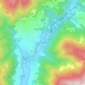
Name: Castel San Felice topographic map, elevation, terrain.
Average elevation: 557 m
Minimum elevation: 281 m
Maximum elevation: 1,119 m
Make a donation
Gear up for your next adventure:
As an Amazon Associate, this site earns from qualifying purchases at no extra cost to you.