Geolocate

Buhian topographic map

Click on the map to display elevation.

About this map

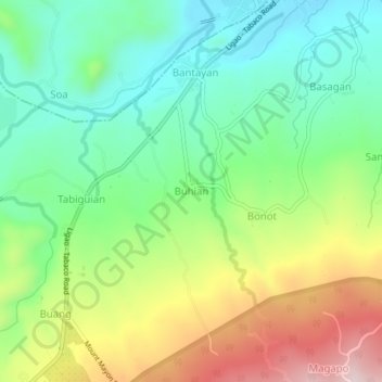
Name: Buhian topographic map, elevation, terrain.

Location: Buhian, Tabaco, Albay, Bicol Region, 4511, Philippines (13.30434 123.63636 13.34434 123.67636)

Average elevation: 187 m

Minimum elevation: 53 m

Maximum elevation: 418 m

Other topographic maps

Click on a map to view its topography, its elevation and its terrain.

Gear up for your next adventure:

🏃Hydration Running Vest - Carry water and maps close to your body for speed
🥾Trail Running Boots - Durable shoes designed for trail running
🥾Lightweight Hiking Shoes - Comfortable shoes for day hikes
🛶Kayak Dry Bag - Waterproof storage for kayaking adventures
🔦LED Flashlight - Powerful and long-lasting flashlight for camping and emergencies

As an Amazon Associate, this site earns from qualifying purchases at no extra cost to you.