Geolocate

Rødberg topographic map

Click on the map to display elevation.

About this map

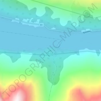
Name: Rødberg topographic map, elevation, terrain.

Location: Rødberg, Tromsø, Troms, Norway (69.58160 20.03421 69.58170 20.03431)

Average elevation: 244 m

Minimum elevation: -1 m

Maximum elevation: 1,218 m

Other topographic maps

Click on a map to view its topography, its elevation and its terrain.

Tromsøya - Romssasuolu

Norway > Troms > Tromsø

Average elevation: 74 m

Gear up for your next adventure:

Family Camping Tent - Spacious tent suitable for family camping trips
🥾Hiking Shorts - Breathable shorts suitable for summer hikes
🔦UV Flashlight - Detect minerals or specific insects in the dark
Camping Groundsheet - Protect your tent from moisture and dirt
🔭Compact Binoculars - Lightweight optics for scouting trails and wildlife

As an Amazon Associate, this site earns from qualifying purchases at no extra cost to you.