
Thank you for supporting this site ❤️
Make a donation
Make a donation
Gear up for your next adventure:
As an Amazon Associate, this site earns from qualifying purchases at no extra cost to you.
Yuvacık topographic map
Click on the map to display elevation.
Thank you for supporting this site ❤️
Make a donation
Make a donation
Gear up for your next adventure:
As an Amazon Associate, this site earns from qualifying purchases at no extra cost to you.
About this map
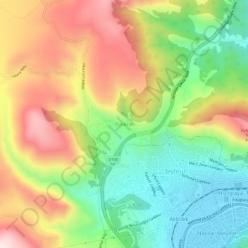
Name: Yuvacık topographic map, elevation, terrain.
Location: Yuvacık, Amasya, Black Sea Region, 05100, Turkey (40.64505 35.76987 40.68505 35.80987)
Average elevation: 634 m
Minimum elevation: 394 m
Maximum elevation: 936 m
Thank you for supporting this site ❤️
Make a donation
Make a donation
Gear up for your next adventure:
As an Amazon Associate, this site earns from qualifying purchases at no extra cost to you.