Geolocate

Conyers topographic map

Click on the map to display elevation.

About this map
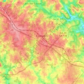
Name: Conyers topographic map, elevation, terrain.

Location: Conyers, Rockdale County, Georgia, United States (33.62497 -84.04573 33.69510 -83.92308)

Average elevation: 251 m

Minimum elevation: 193 m

Maximum elevation: 292 m

Gear up for your next adventure:

🧢Outdoor Visor - Breathable visor for sunny hikes
🧦Thermal Socks - Warm socks for winter hiking or camping
🧭GPS Handheld Device - Reliable GPS navigation for outdoor adventures
🥾Hiking Shorts - Breathable shorts suitable for summer hikes
🧦Outdoor Socks - Durable socks designed for hiking and outdoor sports

As an Amazon Associate, this site earns from qualifying purchases at no extra cost to you.