Geolocate

Karangampel topographic map

Click on the map to display elevation.

About this map

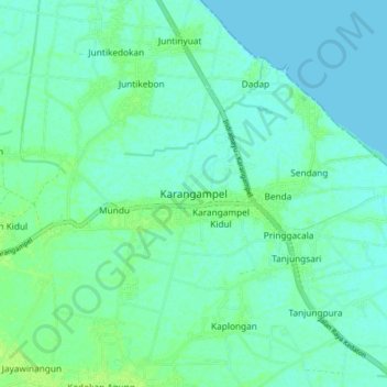
Name: Karangampel topographic map, elevation, terrain.

Location: Karangampel, Indramayu, West Java, Java, Indonesia (-6.50355 108.40023 -6.42355 108.48023)

Average elevation: 4 m

Minimum elevation: 0 m

Maximum elevation: 12 m

Gear up for your next adventure:

🐕Hiking Dog Pack - Let your canine companion carry their own water and food
🚲MTB Frame Bag - Carry tools and maps directly on your bicycle frame
💧Reusable Water Bottle - Durable water bottles for hydration on trails
🧭Orienteering Kit - Tools for map reading and navigation in the wild
🧦Crew Hiking Socks - Comfortable socks for long-distance hikes

As an Amazon Associate, this site earns from qualifying purchases at no extra cost to you.