
Niagara River topographic map
Click on the map to display elevation.
Niagara River
The river, which is occasionally described as a strait, is about 58 kilometres (36 mi) long and includes Niagara Falls in its course. The falls have moved approximately 11 kilometres (6.8 mi) upstream from the Niagara Escarpment in the last 12,000 years, resulting in a gorge below the falls. Today, the diversion of the river for electrical generation has significantly reduced the rate of erosion. The total drop in elevation along the river is 99 metres (325 ft). The Niagara Gorge extends downstream from the Falls and includes the Niagara Whirlpool and another section of rapids.
About this map
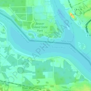
Name: Niagara River topographic map, elevation, terrain.
Average elevation: 177 m
Minimum elevation: 171 m
Maximum elevation: 203 m