Geolocate

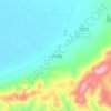
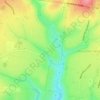
St Leonards topographic map

Click on the map to display elevation.

About this map

Name: St Leonards topographic map, elevation, terrain.

Location: St Leonards, City of Greater Geelong, Victoria, 3223, Australia (-38.21997 144.64090 -38.14280 144.72010)

Average elevation: 5 m

Minimum elevation: -2 m

Maximum elevation: 33 m

Other topographic maps

Click on a map to view its topography, its elevation and its terrain.
Brimbank Park

Australia > Victoria > Melbourne

Average elevation: 52 m

Lyonville

Australia > Victoria

Average elevation: 729 m

Mount Abrupt

Australia > Victoria

Average elevation: 422 m

Warrenheip

Australia > Victoria > Ballarat

Average elevation: 532 m

Woolamai

Australia > Victoria

Average elevation: 62 m

Poverty Point

Australia > Victoria > Ballarat

Average elevation: 437 m

East Pinnacle

Australia > Victoria

Average elevation: 1,099 m

Rutherford Park

Australia > Victoria

Average elevation: 519 m

Fawcett Hill

Australia > Victoria

Average elevation: 287 m

Mount Loch

Australia > Victoria

Average elevation: 1,648 m

Mount Albert

Australia > Victoria

Average elevation: 414 m

Renfew Court Reserve

Australia > Victoria > Melbourne

Average elevation: 131 m

Observatory Hill

Australia > Victoria > Portland

Average elevation: 9 m

Broadford

Australia > Victoria

Average elevation: 253 m

Gear up for your next adventure:

🚲Heavy Duty Bike Lock - Secure your bike at the trailhead or during stops
🥾Hiking Shorts - Breathable shorts suitable for summer hikes
🥾Waterproof Hiking Boots - Boots keeping your feet dry in wet conditions
🧴Sunscreen SPF - Broad-spectrum sunscreen for outdoor activities
⛺Camping Essentials - All-in-one gear for a comfortable camping trip

As an Amazon Associate, this site earns from qualifying purchases at no extra cost to you.