Geolocate

Lohia topographic map

Click on the map to display elevation.

About this map

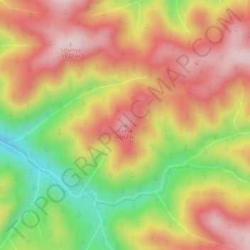
Name: Lohia topographic map, elevation, terrain.

Location: Lohia, Lunca Bradului, Mureș, Romania (46.88641 25.13673 46.88651 25.13683)

Average elevation: 973 m

Minimum elevation: 770 m

Maximum elevation: 1,127 m

Gear up for your next adventure:

🎒Hiking Backpack - Lightweight and ergonomic backpacks for day hikes or multi-day treks
Family Camping Tent - Spacious tent suitable for family camping trips
🛶Kayak Dry Bag - Waterproof storage for kayaking adventures
🔦LED Headtorch - Bright and durable light for night activities
🧥Waterproof Hiking Jacket - Protect yourself from rain and wind while hiking

As an Amazon Associate, this site earns from qualifying purchases at no extra cost to you.