Geolocate

Wajo topographic map

Click on the map to display elevation.

About this map

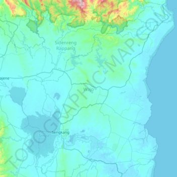
Name: Wajo topographic map, elevation, terrain.

Location: Wajo, Lamata, South Sulawesi, Sulawesi, Indonesia (-4.28650 119.88382 -3.64444 120.44123)

Average elevation: 65 m

Minimum elevation: -2 m

Maximum elevation: 1,171 m

Gear up for your next adventure:

🥾Waterproof Hiking Shoes - Durable shoes for wet and rugged trails
🔋Solar Power Bank - Keep your GPS and devices charged during long outdoor trips
🧤Rechargeable Heated Gloves - Extreme warmth for Canadian winter expeditions
👟Sport Hiking Sandals - Breathable footwear for water crossings and camp rest
🧤Insulated Winter Gloves - Heavy-duty protection for sub-zero Canadian adventures

As an Amazon Associate, this site earns from qualifying purchases at no extra cost to you.