Geolocate

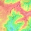
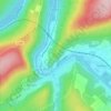
Sugny topographic map

Click on the map to display elevation.

About this map

Name: Sugny topographic map, elevation, terrain.

Location: Sugny, Vouziers, Ardennes, Grand Est, Metropolitan France, 08400, France (49.34359 4.62493 49.36603 4.69543)

Average elevation: 122 m

Minimum elevation: 96 m

Maximum elevation: 191 m

Other topographic maps

Click on a map to view its topography, its elevation and its terrain.
Roche Bayart

France > Grand Est > Ardennes > Château Regnault

Average elevation: 221 m

Crecy

France > Grand Est > Ardennes > Brieulles-sur-Bar

Average elevation: 198 m

La Rubrique

France > Grand Est > Ardennes > Château Regnault

Average elevation: 251 m

Le Hamai

France > Grand Est > Ardennes > Villers-sur-Bar

Average elevation: 175 m

Chiers

France > Grand Est > Ardennes > La Ferté-sur-Chiers

Average elevation: 186 m

La Fontaine des Parades

France > Grand Est > Ardennes > Buzancy

Average elevation: 242 m

Mont Vireux

France > Grand Est > Ardennes > Vireux-Molhain

Average elevation: 151 m

La Rubrique

France > Grand Est > Ardennes > Château Regnault

Average elevation: 251 m

Prau

France > Grand Est > Ardennes > Vireux-Wallerand

Average elevation: 155 m

Georgea

France > Grand Est > Ardennes > L'Écaille

Average elevation: 95 m

Forest

France > Grand Est > Ardennes > Seraincourt

Average elevation: 167 m

Richat

France > Grand Est > Ardennes > Fromelennes

Average elevation: 165 m

Gear up for your next adventure:

🏕️Camping Hammock - Integrated protection for sleeping between trees
🥾Mountain Hiking Boots - High-traction boots for rocky terrain
🥾Trail Hiking Boots - Supportive boots for rough trails
💡Portable Camping Lamp - Rechargeable lamp for campsite lighting
🥾Lightweight Hiking Shoes - Comfortable shoes for day hikes

As an Amazon Associate, this site earns from qualifying purchases at no extra cost to you.