Geolocate

Klego topographic map

Click on the map to display elevation.

About this map

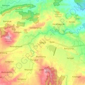
Name: Klego topographic map, elevation, terrain.

Location: Klego, Boyolali, Central Java, Java, 57385, Indonesia (-7.39499 110.65254 -7.31499 110.73254)

Average elevation: 235 m

Minimum elevation: 107 m

Maximum elevation: 379 m

Other topographic maps

Click on a map to view its topography, its elevation and its terrain.

Cluntang

Indonesia > Central Java > Boyolali

Average elevation: 1,033 m

Gear up for your next adventure:

🩹Moleskin Blister Pads - Direct protection for painful foot pressure points
💧Hydration Pack - Hands-free hydration system for long hikes
🧊Portable Cooler - Keep food and drinks cold during outdoor adventures
🧭GPS Outdoor Watch - Smart watch for navigation and fitness tracking in nature
🛏️Sleeping Bag - Warm and compact sleeping bags for outdoor camping

As an Amazon Associate, this site earns from qualifying purchases at no extra cost to you.