Geolocate

Dempet topographic map

Click on the map to display elevation.

About this map

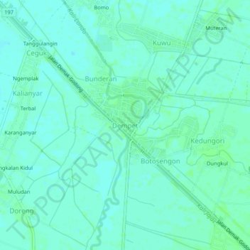
Name: Dempet topographic map, elevation, terrain.

Location: Dempet, Demak, Central Java, Java, Indonesia (-6.97460 110.67756 -6.93460 110.71756)

Average elevation: 7 m

Minimum elevation: 4 m

Maximum elevation: 11 m

Other topographic maps

Click on a map to view its topography, its elevation and its terrain.

Mijen

Indonesia > Central Java > Demak

Average elevation: 5 m

Karanganyar

Indonesia > Central Java > Demak

Average elevation: 7 m

Kali Tuntang

Indonesia > Central Java > Demak > Bonangrejo

Average elevation: 4 m

Bonang

Indonesia > Central Java > Demak

Average elevation: 3 m

Kali Tulung

Indonesia > Central Java > Demak > Gebangarum

Average elevation: 3 m

Gear up for your next adventure:

🧢Hiking Hat - Sun-protective and breathable hats for long treks
🥾All-Terrain Hiking Boots - Versatile boots for varied hiking conditions
🎒Hiking Daypack - Lightweight and durable backpacks for day trips and excursions
💧Hydration Pack - Hands-free hydration system for long hikes
🕶️Polarized Sunglasses - Reduces glare from snow and water at high elevations

As an Amazon Associate, this site earns from qualifying purchases at no extra cost to you.