Geolocate

Menganti topographic map

Click on the map to display elevation.

About this map

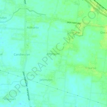
Name: Menganti topographic map, elevation, terrain.

Location: Menganti, Kebumen, Central Java, Java, 54362, Indonesia (-7.70114 109.57537 -7.66114 109.61537)

Average elevation: 11 m

Minimum elevation: 5 m

Maximum elevation: 19 m

Gear up for your next adventure:

🦶Anti-Blister Balm - Prevents friction and hotspots during long ascents
🧭Orienteering Kit - Tools for map reading and navigation in the wild
🧴Waterproofing Spray - Restore the DWR coating on jackets and tents
🥾Hiking Leggings - Comfortable leggings for outdoor activities
🔨Vehicle Emergency Tool - Safety tool for remote road trips to trailheads

As an Amazon Associate, this site earns from qualifying purchases at no extra cost to you.