Geolocate

Tadó topographic map

Click on the map to display elevation.

About this map

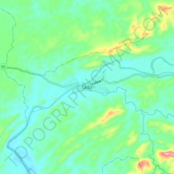
Name: Tadó topographic map, elevation, terrain.

Location: Tadó, San Juan, Chocó, Colombia (5.22397 -76.59874 5.30397 -76.51874)

Average elevation: 108 m

Minimum elevation: 54 m

Maximum elevation: 283 m

Gear up for your next adventure:

🪑Ultralight Camping Stool - Compact seating for rest stops during long hikes
🔋Emergency Crank Radio - Weather alerts and power without needing batteries
🧥Insulated Jacket - Keep warm in cold outdoor conditions
🔥Emergency Fire Starter - Reliable ignition source for all weather conditions
🧰Multitool Knife - Compact and versatile tool for outdoor use

As an Amazon Associate, this site earns from qualifying purchases at no extra cost to you.